

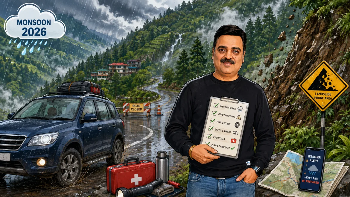
This has been a genuinely active season. The southwest monsoon reached Himachal Pradesh on July 1, 2026, about six days later than its usual date of June 25, and covered the entire state within a day. Meteorologists had already flagged 2026 as a below normal year for the state as a whole, with seasonal rainfall tracking under 92 percent of the long period average of roughly 734 millimeters. A below normal season sounds reassuring, but it is not the same as a safe one. Almost all of the damage this year, as in most years, has come from short, intense, localized bursts of rain rather than steady background rainfall, and those bursts are exactly what triggers landslides and flash floods on hill roads.
As of the most recent state assembly update on August 22, 2026, Revenue Minister Jagat Singh Negi told the house that rain and disaster related incidents had claimed 111 lives across Himachal Pradesh so far this financial year, with Sirmaur district alone accounting for 87 of them, followed by Lahaul and Spiti with 16, Solan with 4, and Mandi, Kangra and Kullu with one or two each. Twelve bridges, 766 houses and hundreds of roads have taken damage over the season. The India Meteorological Department's Himachal Pradesh head, Shobhit Katiyar, said on August 19 that the active phase of the monsoon was expected to weaken considerably after August 23, with no severe weather warning likely for around 45 days after that, though isolated light rain could still fall. That is genuinely good news if you are reading this around today's date, but it is a forecast, not a guarantee, and it says nothing about how long it will take crews to repair roads that are already damaged. Treat the rest of this guide as your working reference, and always confirm current conditions before you actually leave.
Road Closures in Himachal Pradesh This Monsoon
The single most important thing to understand about road closures in Himachal Pradesh during the monsoon is that the number moves fast, in both directions. On July 1, the opening day of the monsoon, the state had 35 roads closed. By around August 9 to 11, during one of the season's most intense spells, that figure had climbed past 260, with Mandi worst hit at close to 120 roads, followed by Chamba, Kullu and Shimla. By August 19 the count had eased to 167 roads, including a stretch of National Highway 3, and by August 20 it had come down further to 146. None of these numbers are fixed. A single overnight cloudburst can undo a week of repair work, and a couple of dry days can reopen dozens of link roads just as quickly. What stays fairly constant, season after season, is which districts carry most of the burden.
Mandi has been the most consistently affected district all season, regularly accounting for more closed roads than any other part of the state, largely because National Highway 3, the main Chandigarh to Manali route, runs straight through some of its most landslide prone terrain. Kullu sits close behind, usually in the 35 to 40 road range during active spells, since it shares that same highway corridor and adds the Aut to Sainj road and several link roads into its side valleys. Chamba, Sirmaur, Shimla, Kangra, Una and Hamirpur typically report closures in the single or low double digits on any given day, though Sirmaur's numbers are deceptive: relatively few roads closed there this season, yet it recorded by far the highest death toll in the state, a reminder that a low road count in a district does not always mean a low risk one. Lahaul and Spiti, despite reporting only a handful of closed roads at any time, has taken some of the worst damage to power infrastructure, with dozens of transformers knocked out in a single week in August, which matters for travelers because it affects everything from mobile charging to fuel pump operation in remote valleys.
Beyond the district level numbers, a handful of specific stretches deserve their own mention, because they come up again and again in this season's reports and in most years before it.
National Highway 3, the Chandigarh to Manali highway, is the route most tourists actually drive, and it has been disrupted repeatedly through July and August 2026, particularly around Dharampur in Mandi district. The Pandoh, Kainchimod and Hanogi stretches, all within Mandi, are long running trouble spots where falling debris and boulders are common enough that the Himachal Pradesh High Court has previously directed the National Highways Authority of India and its contractor to keep extra manpower stationed on the Mandi to Pandoh section specifically to prevent boulder related casualties. There is a partial workaround for this corridor: a bypass via Kandi and Kataula that rejoins National Highway 21 near Bajaura, close to Kullu, though this route can also see landslides of its own during heavy rain.
National Highway 5, the corridor that runs from Kalka and Shimla all the way up into Kinnaur, is really two highways in one as far as monsoon risk goes. The lower section, from Parwanoo through Solan to Shimla, is prone to landslides and rockslides around spots like Datyar and Chakki Mor, and has seen fatal incidents in past seasons when boulders came down onto moving traffic. North of Shimla, the stretch through Rampur, Jeori and Jhakri is known for what locals call shooting stones, sudden rockfall off sheer cut slopes that can happen even in moderate rain with little warning. Further north still, in Kinnaur district itself, this highway has been blocked repeatedly through the 2026 season, including a flash flood at Choling, about 25 kilometers from Reckong Peo, that buried the road under debris and briefly trapped vehicles, and further closures near Nigulsari and Maling Nala. Because there is no meaningful alternate route into Kinnaur or on to Spiti from this side, a closure here does not just slow your trip, it can cut the entire valley off from the rest of the state for hours or, in a bad case, days.
National Highway 305, the Aut to Sainj to Largi road in Kullu district, has seen landslides near Pagal Nala severe enough to snap road connectivity to around 15 villages in past events, and remains a stretch worth checking specifically if your route runs through the Sainj or Tirthan side valleys.
The Pathankot to Chamba highway and the Chamba to Tissa road, the latter particularly around Pangola Nallah, are both landslide and rockfall prone and see recurring, if usually shorter, closures through the season.
The old Shimla to Mandi road via Tatti Pani, in the Sunni area of Shimla district, has in past seasons been scoured so badly by the Sutlej river that its width narrowed to under two meters, unsafe for any vehicle, with the alternate route via Thali bridge also going out at the same time and cutting off the Karsog area entirely.
If your plans include the Manali to Leh highway, the picture is more reassuring than most people expect. The Atal Tunnel, which now carries all traffic under the old Rohtang Pass, runs round the clock throughout the year and needs no separate permit to use. The stretch immediately around it, particularly Rohtang and Gulaba on the Manali side before the tunnel, does see monsoon landslip risk and is worth checking on the morning of travel. Once you are through the tunnel and past Keylong, though, the road toward Sarchu and Leh sits largely in the Himalayan rain shadow and receives comparatively little monsoon rainfall, which is exactly why July and August are actually considered good months to attempt that particular stretch. The main disruption reported on this axis in 2026 was a flash flood near Jispa on June 30, cleared by the Border Roads Organisation the same day.
If you are heading toward Spiti via the Kunzum Pass route from Manali, rather than via Kinnaur, expect multiple glacial melt streams along the Gramphu to Batal to Kaza stretch, including one known locally as Chhota Dhara, that swell noticeably through the afternoon as the day's heat melts snow and ice upstream. Crossing these in the early morning, before the melt peaks, is standard local practice and worth building into your day's timing.
Finally, if your trip includes the Manimahesh Yatra route between Bharmaur and Hadsar, be aware that bridge damage on this stretch has forced the yatra to pause in past monsoons, and pilgrims and trekkers on this route should have a flexible schedule in mind rather than a fixed one.
Landslides: Why Himachal's Roads Give Way Every Monsoon
To drive Himachal Pradesh sensibly in the monsoon, it helps to understand why the state's roads fail the way they do, because the reasons shape almost every piece of practical advice that follows.
Geologically, the Himalayas are young mountains, still actively rising, made up of rock that has not had the tens of millions of years needed to settle into anything stable. Slopes are steep, soil cover is thin, and a great deal of the terrain that roads are cut into is loose, fractured rock rather than solid bedrock. Add heavy monsoon rain, which saturates that thin soil layer and reduces the friction holding it to the slope beneath, and you have the basic recipe for a landslide: gravity doing what gravity does, once the rain removes just enough resistance.
Two related but distinct hazards show up constantly in Himachal Pradesh's monsoon reporting, and it is worth knowing the difference. A landslide is the slower, more visible failure of a slope, rock, earth or debris sliding down under its own weight, sometimes triggered gradually over days of rain and sometimes in one sudden collapse. A cloudburst, by the India Meteorological Department's definition, is something more violent and localized: more than 10 centimeters of rain falling within a single hour over an area of roughly 10 square kilometers. Cloudbursts are what produce the flash floods that wash away roads, bridges and sometimes entire hamlets within minutes, with very little warning. Himachal Pradesh recorded three confirmed cloudbursts this season as of the August 22 assembly update, in Bhuntar tehsil of Kullu district and in the Shugu Khangsar and Dondal Nala Karpat areas of Lahaul and Spiti, though officials noted no deaths were directly linked to those three specific events.
Human activity layers additional risk on top of this natural fragility. Road widening and four laning projects, several of which have continued through the monsoon rather than pausing for it, involve fresh cutting into hillsides at exactly the time those hillsides are least stable. Unregulated construction on steep slopes, reduced forest cover in places, and drainage that cannot always keep pace with sudden downpours all add to the same underlying problem. None of this is unique to 2026, but it is worth knowing that this is a structural feature of Himalayan road travel, not a one off bad year, which is why the same corridors named above turn up in monsoon reporting almost every single season.
For travelers, the practical takeaway is simple even if the geology is complicated. Landslide risk in Himachal Pradesh is not evenly spread across the state or across the season. It concentrates on specific stretches, mostly the ones already named in the road closures section above, and it concentrates during and immediately after intense rain rather than during steady, gentle drizzle. Planning your travel around active weather alerts, rather than around the calendar alone, does more to keep you safe than almost anything else in this guide.
Safety Tips for Driving in Himachal Pradesh This Monsoon
Plan your timing around the weather, not just the calendar. Check the day's district level alert color, green, yellow, orange or red, before you set out each morning, and treat an orange or red alert as your cue to hold your plans for that day rather than push through them. Build a couple of buffer days into any monsoon itinerary so that a closed road costs you a quiet extra day in a cafe, not the rest of your trip. A slower travel style generally serves you better in the hills this time of year: pick one or two base towns and take day trips from them, rather than switching hotels every night along a long circuit. Towns such as Shimla, Mashobra, Chail, Dharamshala, McLeodganj, Kasauli, Narkanda, Solan, and the Tirthan and Jibhi valleys tend to have more resilient, better connected road links than remote single road destinations, which makes them sensible bases during an active spell of rain.
Travel by daylight and aim to finish driving well before dusk. Debris clearance, diversions and rescue work all become considerably harder after dark, and so does spotting fresh damage on the road ahead. If a day's drive is running long, stop for the night at the next reasonable town rather than pushing to reach your original destination after sunset.
Drive to the conditions, not to the speed limit. Keep your speed steady and moderate on wet hill roads, and increase your following distance, since both standing water and loose gravel washouts extend stopping distance well beyond what you would expect on a dry plains highway. Sound your horn on blind curves, standard hill driving practice that warns both you and oncoming traffic in good time. Keep the car moving at a steady pace through open stretches below freshly cut or visibly loose slopes, and treat fresh debris, newly placed warning tape or a stationed police vehicle as your signal to keep driving through calmly rather than stopping to take a photo. When you do want to stop, use a marked viewpoint or parking bay, never the outer edge of a hairpin bend or a spot directly under a vertical rock face.
Time your stream and nullah crossings for the morning. Glacial and rain fed mountain streams, particularly on high altitude approaches like the Spiti route via Kunzum Pass, run at their lowest early in the day and swell through the afternoon as the sun melts snow upstream. If you do reach a flooded crossing, let it settle and check with other drivers or a local before attempting it, rather than judging the depth by eye from the driver's seat.
Follow official direction over app direction. Traffic police and district administration staff on the ground know about a closure within minutes; your navigation app may take hours to catch up, and in a remote valley, it may never update at all. When the two disagree, go with the person standing in the road.
Prepare the vehicle before you leave the plains. Have brakes, tyres, wipers, headlights and coolant checked properly before departure, since Himachal's grades and hairpin bends ask considerably more of a vehicle than ordinary city driving. If you are driving a hatchback or sedan with lower ground clearance, an underbody protection plate is a sensible addition, and if your car sits under roughly 170 millimeters of clearance, plan your route around the roughest high altitude tracks, such as Jalori Pass or the Chanshal Valley road, rather than attempting them. Pack and balance your luggage evenly across the car rather than loading everything into the boot, since a rear heavy car handles noticeably worse on switchbacks, and keep the fuel tank topped up at the last sizeable town before a remote stretch, since pumps thin out fast beyond Kullu, Kaza, Keylong and Reckong Peo.
Build the trip around your family's actual pace, not an ideal one. Frequent short breaks work well for children on long hill drives, and they double conveniently as natural checkpoints to reassess the weather and road conditions as you go. Keep a compact emergency kit in the car at all times in the hills: a torch, a basic first aid kit, a tow rope, drinking water and some dry snacks cover most minor situations. Share your planned route and expected arrival time with someone outside the group before you set off each day, since phone signal drops out for long stretches in Kinnaur, Lahaul and Spiti and parts of upper Chamba, and it is far easier for someone to raise an alarm on your behalf if they know roughly where you should be.
What Travelers Should Check Before Leaving
Treat this as your working checklist. None of it takes long to go through, and together it covers almost every situation that actually catches monsoon travelers out in Himachal Pradesh.
Weather and road status, from more than one source. Start with the India Meteorological Department's Shimla office, which publishes the day's district wise color coded alerts. Cross check this against advisories from the State Emergency Operation Centre and the Himachal Pradesh State Disaster Management Authority, both of which post updates through the day during active weather. Where possible, follow the specific district administration or traffic police social media account for the district you are entering, since local accounts often carry road status faster than statewide news coverage does. A community driven platform such as Himachal Road Status can add useful, driver reported, ground level detail, though it is best used alongside official sources rather than in place of them. Checking whether HRTC has suspended bus services on your intended route is another quietly reliable signal, since the corporation tends to pull buses off a stretch as soon as it becomes genuinely unfit for any vehicle, not only heavy ones.
Permits and paperwork for your specific route. If you hold an Indian passport, you do not need an inner line permit for the Shimla to Kinnaur to Spiti route or for travel into Lahaul; a valid photo identity document and your vehicle papers are enough. If you are traveling on a foreign passport, you will need a Protected Area Permit, sometimes called an inner line permit, to enter upper Kinnaur beyond the Jangi and Dubling check points, and for named Spiti villages including Kaza, Tabo, Dhankar, Nako, Gompa, Morang and Khab. This permit is issued in person, not online, at the district magistrate or sub divisional magistrate office in Shimla, Reckong Peo, Kullu, Keylong or Kaza, and it is worth sorting out at the first major town on your route rather than waiting until you are deep in the valley with no administrative office nearby. Private vehicles entering Lahaul are required to register on the e Aagman portal. A separate Rohtang Pass vehicle permit only comes into play if you choose to drive the old pass road instead of the Atal Tunnel; the tunnel itself needs no permit at all. Vehicles entering Spiti also pay a district development fee at the entry barrier, commonly referred to locally as the SADA fee, which is a fee rather than a permit and has nothing to do with your nationality.
Your own vehicle documents, in more than one form. Carry your registration certificate, insurance, pollution certificate and driving license as physical copies as well as photos saved on your phone, since patchy network coverage can make it genuinely difficult to pull up a digital copy at a check post when it matters.
Emergency numbers, saved before you need them. The State Disaster Helpline (1070) and your District Disaster Helpline (1077) are staffed round the clock throughout the monsoon by the Himachal Pradesh State Disaster Management Authority, and are the right numbers to call for landslides, flash floods, road blockages or any other emergency on the road. Save both in your phone before you leave home, not after you need them.
Cash, fuel and offline maps. Carry more cash than you normally would on a plains trip, since ATMs become sparse past the district headquarters towns, and card payments can be unreliable in Lahaul, Spiti and upper Kinnaur. Top up your fuel tank at the last sizeable town before any remote stretch. Download offline maps for your entire route in advance, since mobile data genuinely disappears for long stretches once you are into the tribal districts.
Flexible accommodation and honest insurance cover. Book rooms with a flexible or free cancellation policy through the monsoon months, and if you are booking a homestay directly rather than through a larger platform, confirm its own cancellation terms with the owner in writing. If you hold travel insurance, check specifically whether it covers weather related trip delay or cancellation, since a good number of standard policies do not.
A short recap for the morning you actually leave. Before you start the car, run through this list one more time: today's district alert color for every district on your route, the current road status for that route from at least two sources, a full tank of fuel and correct tyre pressure, your emergency numbers saved and your route shared with someone back home, and a flexible plan B halt point in mind in case your primary route is blocked.
The Final Word
Nothing in this guide is meant to talk you out of a Himachal Pradesh trip this monsoon. The state's own tourism officials have said as much through the season: major destinations including Shimla, Manali, Dharamshala, Dalhousie and Kasauli have stayed open and safe through 2026's monsoon, and the appeal from local authorities has consistently been to travel with caution around vulnerable stretches, not to stay away. Millions of families drive through these hills every year, and the overwhelming majority of those trips go by without incident. What separates a smooth trip from a stressful one is almost never luck. It is checking the alert before you leave the hotel, building in a spare day, keeping the car prepared, and being genuinely willing to wait out a bad morning rather than push through it. Do that, and monsoon Himachal, quieter, greener and considerably less crowded than peak season, is very much worth the drive.
Road closures, alert levels and permit rules change quickly through the monsoon. The details above reflect the situation through late August 2026 and are meant as background and planning context, not as a live status check. Always confirm current conditions directly with IMD Shimla, the Himachal Pradesh State Disaster Management Authority and local police before you set out.
Continue exploring
Related guides, articles, and videos
These recommendations are matched to this Blog using its destinations, routes, vehicles, and practical travel topics.
Recommended travel guide
India Road Trip Guides
Practical route planning, packing, timing, toll, food-stop, and family comfort guidance for Indian road trips.
Open this topic guideRelated reading